Travel

AAA maps still point the way in the modern world

A AAA map negative of the area around Flagstaff, Arizona

What do AAA mapmakers do today, in a world where people can get GPS directions from smartphones? 

Up-to-date AAA city maps were once great for figuring out how to get around town, and AAA's legendary paper TripTiks were indispensable tools for road trips. Now that mobile phones and mapping apps have taken over the rote work of turn-by-turn navigation, what do AAA cartographers do? 

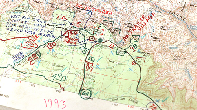
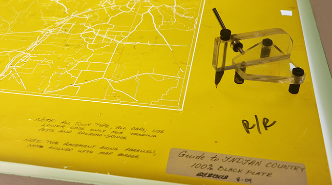
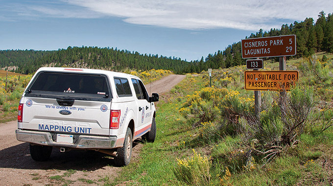
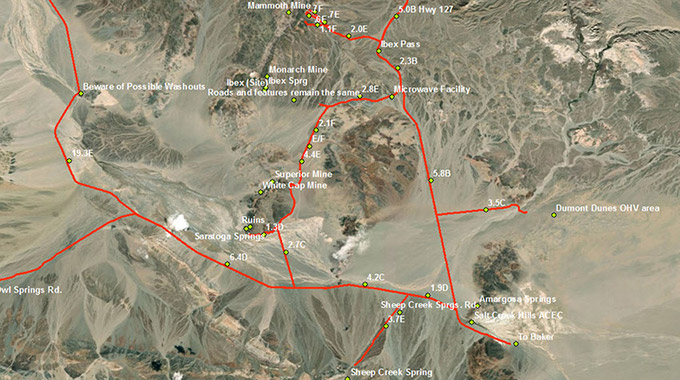
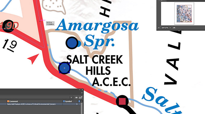
Turns out, quite a lot. That's why the Automobile Club of Southern California still has nine cartographers, including one who works in the field. For all the new tech that exists, printed AAA maps continue to answer essential questions about traveling: What should we see, and what's the best way to see it? AAA cartographers Alyson Stanton and Daniel Gonzalez explain how their work has changed with the times, and what printed maps offer in the digital age.

Why AAA maps are still in high demand

The Auto Club issued its first maps in the 1909 TourBook. The road network was expanding quickly as the automobile became more widespread, and the Auto Club set out to help the growing motoring public navigate this new world. "Originally, the Auto Club was doing the sign posting and charting the early network of roads in Southern California," Stanton says. "That was the beginning of mapping."

These maps led to the design and distribution of local city maps for members' everyday navigation questions—"how to get from their house to Aunt Susie's house, and from Costa Mesa to Glendora," as Stanton puts it. For the next century, such city maps were AAA's most popular, until navigation apps replaced them.

Street map from 1932, depicting the streets around the Los Angeles Memorial Coliseum.

This city map from 1932 illustrates the street grid around the Los Angeles Memorial Coliseum, which was called the Olympic Stadium during the 1932 Olympic Games. These kinds of maps helped drivers get around in everyday life.

But while navigation apps can easily provide driving directions, they're not equipped to handle bigger questions: What are the must-see attractions on your trip? What are the hidden gems? Which route is more scenic? Where should you stay? When is the best time of year to visit? Many apps can suggest options, but there's no way to know if they're missing something. On the flip side, trying to improvise a route can be difficult, especially if you're already on the road.

Stanton says that's where AAA travel maps come in as all-in-one planning resources. "What is now more popular are our series of region maps, which cover multiple counties with recreation information and parks, camping, boating," she says. "With the guide maps, our most popular series, we try to capture the main attractions. ... For our Metro L.A. map, it captures all the main places a tourist may want to see if they're coming to California for the first time. We're doing the leg work up front."

AAA's national park guide maps are particularly useful. "When you go to Yosemite, often you can't get cell service," Stanton points out, while AAA maps can lend assistance even on a backcountry road. "They also cover areas surrounding the park," she adds. "Our Joshua Tree map is about the park, but it's also about the community surrounding it, the hip art scene, and will also point out places to visit just beyond the park boundary."

A close-up of the AAA Yosemite National Park guide series map.

AAA's Yosemite National Park guide series map includes information on points of interest, lodging, and campgrounds, along with a map of the entire park and a close-up map of Yosemite Valley.

An extreme close-up of the AAA Yosemite National Park guide series map, discussing points of interest like the Mariposa Grove.

Guide series maps can help visitors find lesser-known points of interest they might otherwise miss, such as Yosemite's Kaiser Pass Road and Tuolumne Meadows.

Another benefit of AAA maps stems from the work of field cartographer Shane Henry, who maps out-of-the-way roads to see if they're drivable. "If you just want to go somewhere different or get away from it, all our maps show you where to go," Stanton says. "Of course, you have to read the map and figure out the directions yourself. But we know someone's driven the road and it was safe."

Map making, then vs. now

The Auto Club's earliest maps were tall and narrow strip maps that only showed main touring routes. Field cartographers would begin with copies of topographic maps from the U.S. Geological Survey, verifying roads and drawing new ones while noting distances and the quality of the road surface. In-office cartographers would use the field notes to draw the AAA maps in precise detail with ink on enormous vellum canvases in a process as drafting. Members received smaller copies of these maps.

Historic strip maps of Southern California.

These three strip maps of the coastal route between Los Angeles and San Diego illustrate how these small, narrow maps (3.75 inches by 10.5 inches) on heavy cardstock combined to cover long-distance trips in 1926, when there were few alternate routes.

Over time, map drafting was replaced by a process called scribing. Map elements were etched, or "scribed," into plastic-coated sheets, and road labeling was done in type on film.  Instead of being drawn, the map elements were scribed into colored film. This process eliminated the need to hand-ink all map features. The field cartographers' work remained mostly unchanged—they continued hand-tracing on U.S. Geological Survey topographic maps into the 1990s.

A topographical map of the South Rim of the Grand Canyon.

A U.S. Geological Survey topographic map bears a field cartographer's notes from a survey of the Grand Canyon in 1993. Many of the notes concerned changes to points of interest that were applied to the Indian Country map.

Yellow map sheet with etching tool.

Auto Club cartographers once created maps by etching roads, landmarks, and other elements into color-coded plastic sheets. Each layer contained a different element; this yellow sheet is for roads and highways.

The arrival of the digital age changed things once more. Rather than drawing roads by hand, Henry now drives a truck with high-tech equipment that automatically tracks the locations and distances of the roads via GPS.

Like the field surveyors of old, Henry notes whether features listed on the map are still present, checks that roads are publicly accessible, and grades the road surface from A to F. Henry’s job as a field cartographer still serves the same purpose, but "he now can deliver the information digitally instead of writing everything down on paper."

All this data is uploaded using mapping software, then organized and processed for interpretation by cartographers back at the office. They use it to update the AAA maps, now edited and stored on computers. AAA cartographer Daniel Gonzalez says maps are forever changing—many times, new roads are identified on public satellite imagery, then charted by Henry for future updates.

The Auto Club Mapping Unit truck on the road.

Today, AAA field cartographer Shane Henry surveys roads in a truck with specialized equipment that automatically captures data such as road distances and coordinates. Henry records other information, such as road surface quality. (Mapping truck and Shane Henry photos courtesy of Jim Benning.)

Geographic data in ArcGIS

The data from Henry and the Mapping Unit truck is uploaded into the computer system so cartographers in the office can access it and see it overlaid on a topographic map.

Close-up of final map drawn in computer illustration program.

Cartographers like Daniel Gonzalez apply the notes and data to the master map, which now exists as a digitally illustrated file.

Unfold a world of possibilities with AAA maps

AAA members can visit a branch to get free maps1

  • Guide series maps that provide all-in-one-planning for national parks and other popular destinations
  • Regional series maps that cover multiple counties with recreation information
  • Historical series maps from AAA's early years

Find a branch

Go behind the scenes with AAA field cartographer Shane Henry

While researching AAA maps, field cartographer Shane Henry has spent nearly 20 years driving some of the most treacherous roads in the Southwest. Read about what Henry's job involves, and how he's continuining a proud tradition of AAA mapping. 
 

See what he does

back to top icon